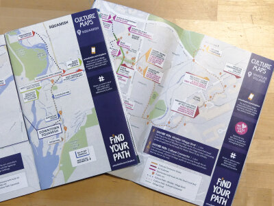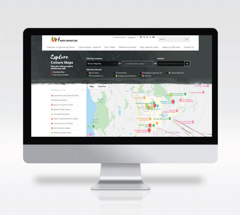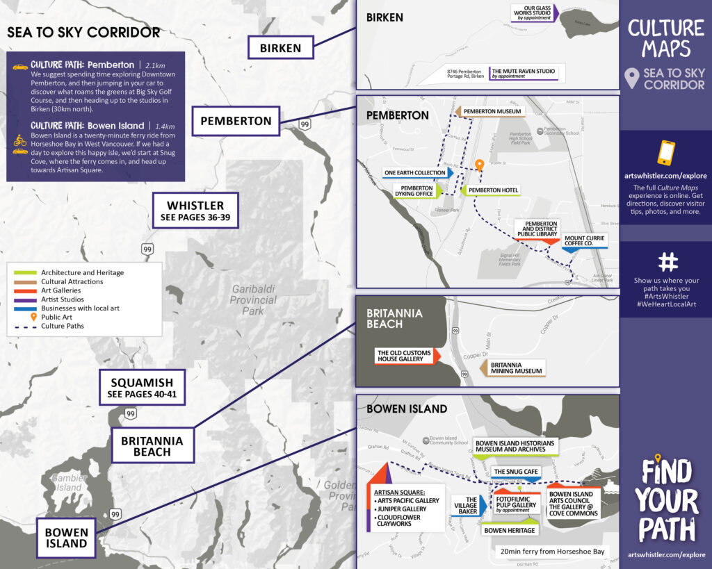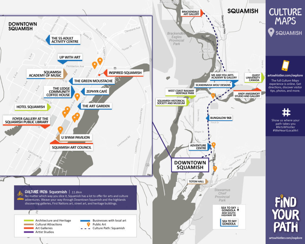
Culture Maps
the project: culture paths
Culture Maps showcase cultural attractions, First Nations Art, Artist Studios, Galleries, Heritage locations and public art for visitors to make their own itinerary and discover the creative side of the Sea to Sky. The First year focused on Whsitler and then expanded to include the entire Sea to Sky Corridor from Bowen Island to Mt Currie.
Included in the 3x/year Arts Scene publication as well as the mobile compatible online directory and maps.
project direction, map illustration, community outreach, web, and social content creation, and digital advertising